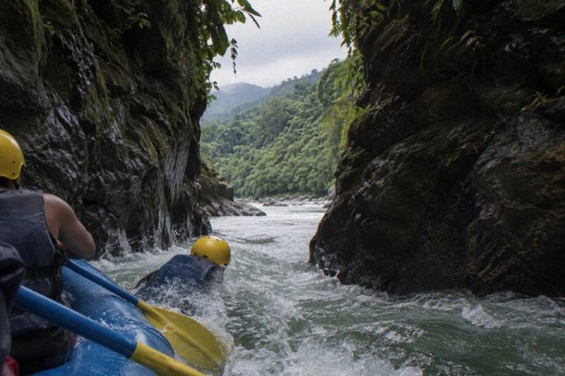
Which Way Does The Pacuare River Flow?
The Pacuare River runs from the Cordillera de Talamanca down to the Caribbean coast in Limon province. Here is the full geography, and what the flow direction means for rafting trips.
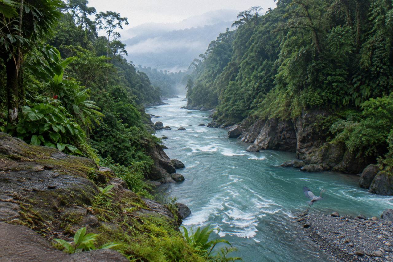
The question sounds like trivia, but on this river the answer is practical. The Pacuare drains the Caribbean slope of Costa Rica, which means it carries rainwater from the Talamanca mountains down toward the sea the same way it carries every raft: from the highlands to the coast. Once you hold that picture, the logistics of a rafting day, the early pickups, the long downhill drive from the interior and the take-out in the Caribbean lowlands all click into place.
The Pacuare River flows from the mountains to the sea: it rises in the Cordillera de Talamanca and empties into the Caribbean, in Limon province. The Spanish and English geographic records agree on the direction even where they disagree on the total length, with figures ranging from about 108 to 133 km depending on the source. Every commercial rafting descent follows that same downhill line toward the coast.
The direction matters because Costa Rica is a country with two slopes and two different water personalities. Rivers on the Pacific side and rivers on the Caribbean side behave differently through the year, and the Pacuare sits firmly on the Caribbean slope. It gathers water from Talamanca and delivers it to the Caribbean lowlands. The name itself comes from that region: "Pacuare" means "baby macaw" in the Cabecar language, pronounced Pa-Kwa-Ray, an indigenous name for a river that still runs through Cabecar territory.
Because the river flows to the Caribbean, the rafting trip also flows to the Caribbean. Rafts put in at the upstream end of the commercial stretch and take out downstream, closer to sea level, which is why so many operators stage their operations centers near Siquirres, the lowland town at the bottom of the run. Siquirres sits at roughly 62 m elevation; Turrialba, upstream in the interior, sits at about 648 m. The river connects those two worlds, and a rafting day is essentially a controlled descent from one to the other.
The one-day trips from Turrialba start close to the top of the commercial stretch, and the two-day lodge trips simply spread the same descent over two days with a night at a riverside lodge in the middle.
Where Does The Pacuare River Start?
The Pacuare rises in the Cordillera de Talamanca, the high mountain chain in southern Costa Rica. From those headwaters it runs through the protected forest reserve toward the Caribbean lowlands, picking up tributaries including the Siquirres, Suru, Peje and Piedras Blancas rivers along the way.
The Talamanca range is the source, and its height explains the volume. Rain that falls on those slopes has nowhere to go but down and east, and the Pacuare channel collects it. The river corridor is protected as a forest reserve, which is a large part of why the gorge still looks the way it does: steep rainforest walls, waterfalls entering directly from the canyon sides and almost no road access along most of the run.
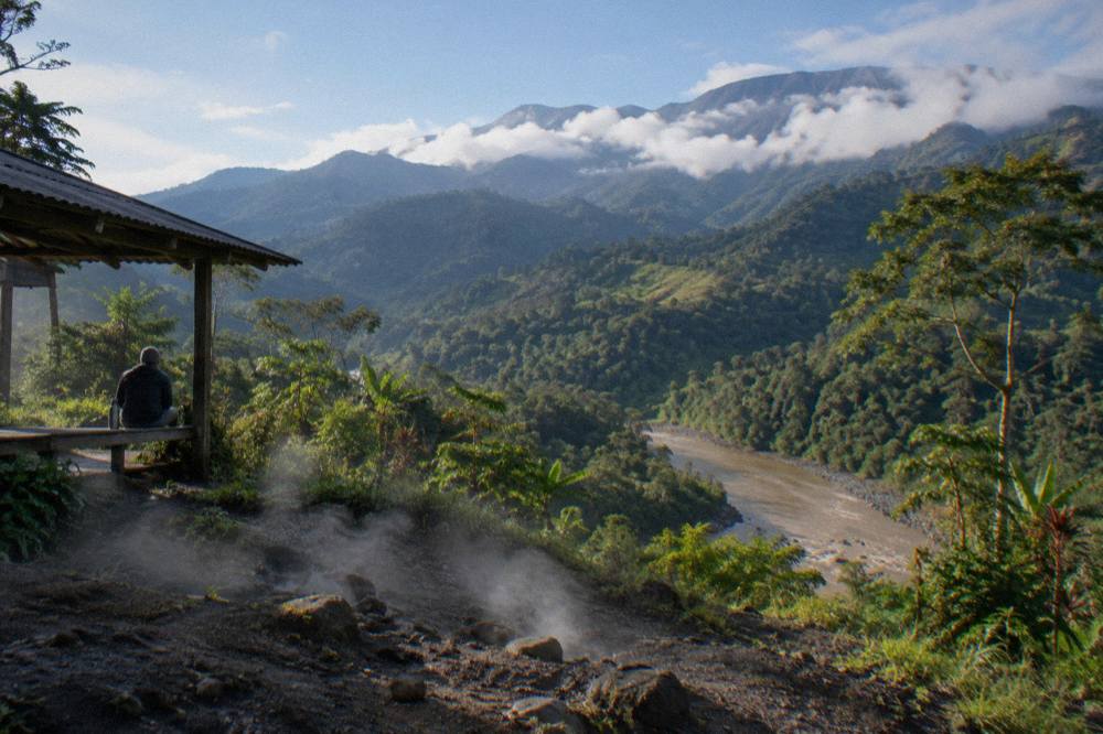
The dam history is worth knowing here because it nearly changed everything. The national electricity institute proposed a hydroelectric dam on the Pacuare in 1986, and the plan was rejected in 2005 after years of opposition grounded in pollution, tourism and ecology concerns. A later presidential decree barred large hydroelectric projects on the main channel, though the exact legal basis of that protection varies by source, so the honest summary is simpler: the river is protected, it is free-flowing, and the rafting industry exists because of both.
That free flow is what a rafting day is built on. There is no automated flow gauge on the river; operators read the water the old way, including a painted rock marker one operator describes using downstream of a river lodge, where red and higher means the river is running too high to run safely. Operators cancel or reroute in high water or flooding, plainly and without drama, and that judgment call is part of the national rafting rules, which require operators to check weather and river conditions.
All of this flows, literally, from the headwaters in Talamanca. For readers who want to see the drainage in person, the most reviewed way in is Rafting Pacuare River One Day from Turrialba, 5.0 from 385 reviews, from $99 per person. There is a fuller walkthrough in the one day Pacuare trip guide for anyone weighing the options. Coming from the Caribbean side, the Puerto Viejo departure is 4.8 from 62 reviews, from $147 per person.
What Sections Make Up The River?
The Pacuare is divided into about sixteen sections in total, of which three are commonly run. The Upper Upper runs about 26 km at Class II to IV, the Upper is a steep Class IV and V creek section, and the Lower, the commercial heart of the river, runs Class III and IV for about 37 km from the Finca La Cruz area to Siquirres, dropping roughly 370 m along the way.
Commercial rafting lives almost entirely on that Lower section. It is the stretch that can be run in a single day or stretched across up to three days with lodge overnights, and it carries the famous named rapids: Upper and Lower Huacas at Class IV, Doble Drop at Class III, and Cimarrones at Class IV, all inside the Huacas River Gorge. The gorge is the signature of the river, a stretch where the canyon walls close in and waterfalls, including one that drops about 150 feet directly into the channel according to operator accounts, come straight off the rock into the current.
| Section | Difficulty | Character | Who runs it |
|---|---|---|---|
| Upper Upper | Class II to IV | About 26 km | Rafters |
| Upper | Class IV and V | Steep, waterfalls, creek kayaking | Expert kayakers |
| Lower | Class III and IV | About 37 km, the commercial gorge run | Almost all commercial trips |
The upstream, downstream logic is easiest to see on the multi-day trips. The 2-Day Tour of the Pacuare River, from $397 per person, starts near Siquirres and works the river as a two-day descent with a lodge night in between. Day-by-day distances vary by operator and water level, so the listing is the place to check what a specific trip covers. The same reasoning applies to the three-day expedition, which simply adds a second lodge night and more of the same downstream line rather than changing direction at any point.
Day trips compress the same idea. Rafting Pacuare River from Turrialba, 5.0 from 196 reviews from $120 per person, and the Turrialba-based Pacuare River Rafting run by Ticos River Adventures, 4.9 from 27 reviews from $119 per person, both put guests on the Lower section and ride it downstream to the lowlands. Exact put-in and take-out points vary by operator, so treat the section table as the map and the listing as the schedule. No operator runs the river upstream, and no shuttle replaces the descent: the water decides the direction, and the logistics bend around it.
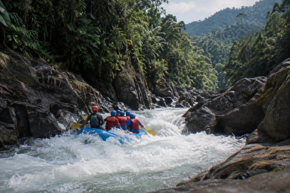
For a visual orientation, the Pacuare River map guide walks through what operators report about access points and how the river connects the interior to the coast, without pretending there is one universal put-in.
Why Does The Flow Direction Matter For Rafting?
Because the river runs to the Caribbean, everything about the day runs downhill too: guests are driven to the top of the run, raft downstream, and finish at a lower, warmer, wetter end of the watershed. Drive times follow the same geometry, with San Jose to Turrialba commonly reported at about 1h20 to 1h40 and San Jose to Puerto Viejo de Talamanca at about 3h30 to 4h25.
That is why San Jose departures start before dawn. Operators commonly report pickups from San Jose hotels between roughly 6:00 and 6:30 a.m., because the capital sits west of the river and the vehicles must cross the interior and descend to the Caribbean slope before the rafting window opens. The return drive retraces the climb in the evening. Turrialba departures skip the long transfer, which is why those trips are shorter on the clock: the most reviewed Turrialba day trip lists a 6-hour total, against 9 to 12 hours for the San Jose versions. Everything else covered here is indexed on Pacuare Costa Rica Rafting.
The direction also explains the water. The Caribbean slope gets rain through much of the year, unlike the Pacific side with its sharper dry season, so the Pacuare keeps flowing when other rivers thin out. ERA5 modelled averages for the Turrialba area put November as the wettest month at 477 mm and March among the driest at 181 mm, and the station cross-check agrees on the pattern: February to April driest, October to December wettest. Water is highest and fastest October to December and lowest March to April, and the river is runnable all year, though operators describe February to April as their preferred window for first timers and families.
Temperature follows the same downward logic. The water is typically around 21 C or warmer, with operator measurements ranging from 21.2 C at high water to 26.2 C at low water in spring, which is why no wetsuit is needed: this is a tropical descent, not an alpine one.
The flow direction even sets the trip options by departure town, because you can only join the river where roads reach it:
| Departure town | Position on the route | What it means for your day |
|---|---|---|
| Turrialba | Interior, near the top of the run | Shortest days, 4 to 8 hour listings |
| San Jose | West, across the interior | Longest days, 9 to 12 hours, early pickups |
| Puerto Viejo | Caribbean coast, downstream side | 7 hours 30 minutes listings, pickup toward the coast |
| La Fortuna | North, via a long transfer | 10 hour listings, sometimes with a shuttle onward |
The La Fortuna option shows the direction working in a traveler's favor: the La Fortuna Pacuare trip with a San Jose airport or Puerto Viejo shuttle, 5.0 from 20 reviews from $150 per person, uses the raft as the middle leg of a journey, finishing downstream and continuing on toward the coast instead of backtracking west.
How Does The River Meet The Caribbean?
The Pacuare reaches the Caribbean lowlands and its mouth sits between the Boca del Parismina and the Urpiano lagoon, near the Matina river, in Limon province. By the time it arrives it has dropped from Talamanca elevations to near sea level, joined its tributaries and passed through the gorge that gives the river its reputation.
The final stretch is flatwater country, and it is no accident that the take-out infrastructure sits there. Post-rafting logistics at the Siquirres-area centers commonly include showers, changing facilities and lunch before the return drives, because the river delivers everyone to the same lowland exit. Siquirres itself is a modest district of about 21,546 people; Turrialba, upstream, counts about 25,334 in its district. The two towns bracket the run.
Upstream of the mouth, the story of the river's first descents belongs to the kayaking era: Polish kayakers made the first descent in the winter of 1980/81, and the first rafting expedition followed in February 1981. Commercial rafting on the Lower section grew from there into the industry whose listings we compare on this site, from the $99 Turrialba day trips to the $505 three-day expedition that spreads the full descent across three days and two lodge nights.
The private Pacuare River trip above, 4.9 from 204 reviews from $125 per person, is another Turrialba option on the same downstream line. The direction of the water never changes between these products; what changes is where you join it, how long you stay on it and who is in the raft.
For readers planning around the coast end, the Pacuare rafting from Puerto Viejo guide covers the Caribbean-side departures, including White Water Rafting Pacuare River with Lunch From Puerto Viejo, 4.8 from 62 reviews from $147 per person, which joins the river from the downstream side.
What Else Does The Geography Explain?
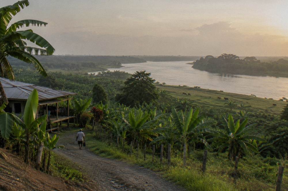
A surprising amount: why the river has no reservoir, why the rapids are where they are, why the wildlife corridor survives, and why the Cabecar communities along the banks still hold land in the watershed. The mountains-to-sea flow created a single continuous rainforest corridor from the highlands to the sea, and nearly every distinctive feature of a Pacuare trip traces back to it.
The rapids are the geology of the descent made visible. A river that drops roughly 370 m over the Lower section alone has to spend that energy somewhere, and it spends it in the stepped rapids of the gorge, where the channel narrows and the gradient steepens. The grade of the standard run depends on water: one operator describes its Pacuare trip as Class 4 at high water and Class 3+ at low water, which is a useful reminder that the class label is a range, not a fixed property.
The corridor explains the wildlife, too. Guests and operators commonly report toucans, sloths, parrots and monkeys along the banks, though no sighting is ever promised; the honest phrasing is that a continuous forest from mountains to sea makes sightings likely, and the Pacuare wildlife guide goes deeper on what lives in the gorge.
The primary geographic record of the river's course and mouth is maintained at the Pacuare River reference page, and the operator community's own accounts of the first descents fill in the human history on top of it.
The Turrialba rafting listing above, 4.9 from 27 reviews from $119 per person, is a good example of geography compressed into a listing: a 4-hour total, a deli-style lunch, transport from Turrialba and a safety kayak on the water, all because joining the river near the top of the run keeps the day short.
By now the direction should feel less like trivia and more like the organizing fact of the whole watershed. Mountains to sea, interior to Caribbean. Whether you ride it in six hours from Turrialba, in a day from San Jose or Puerto Viejo, or across two or three days with a night in a river lodge, you are following the same water downhill, and these two trips are the most direct ways to do it:
Common Questions About The Pacuare River
Which Way Does The Pacuare River Flow?
From the mountains to the sea. The river rises in the Cordillera de Talamanca and empties into the Caribbean in Limon province, with its mouth between the Boca del Parismina and the Urpiano lagoon near the Matina river. Every commercial rafting descent follows the same downstream direction.
Where Does The Pacuare River Start?
It rises in the Cordillera de Talamanca, Costa Rica's southern mountain chain, and gathers tributaries including the Siquirres, Suru, Peje and Piedras Blancas rivers on its way to the Caribbean.
How Long Is The Pacuare River?
The figure is contested: English sources say about 108 km, Spanish sources and one operator say 133 km. The honest answer is about 108 to 133 km depending on the source.
What Class Of Rapids Does The Pacuare Have?
The commercial Lower section runs Class III and IV. One operator grades it as Class 4 at high water and Class 3+ at low water, so the difficulty moves with the season.
Can You Raft The Whole River In One Day?
Day trips cover the Lower section, the commercial gorge run. The full river is not run commercially in a day; longer stretches are covered on two and three day lodge trips.
Why Do Pacuare Trips Leave So Early In The Morning?
Because the river flows down to the Caribbean while most guests start in the interior or the capital. Operators commonly report San Jose pickups between roughly 6:00 and 6:30 a.m. so the descent can finish with time for lunch and the return drive.